 |
South India Hill Station
|
 |
|
|
|
|
|
|
|
South India is blessed with some of the most popular hill stations like
Anantagiri, Coonoor, Coorg, Idukki, Kodaikanal, Munnar, Ooty and Peermade to
name a few. Clean fresh air, spice & tea plantations and clear waterfalls of the
hill stations of South India will calm your mind and rejuvenate you. Known for
their natural beauty, accessibility and ease of travel; the hill station in
South India are excellent retreat for any holiday occasion. Whether you are on
your honeymoon, family vacation or a corporate trip, south Indian hill stations
are just the place to be.
|
|
|
|
|
These are some famous Hill station in South India. |
|
|
Ooty |
|
|
Kodaikanal
|
|
|
Munnar |
|
|
Coorg
|
|
|
Wayanad |
|
|
|
|
|
|
|
|
|
|
Ooty |
|
Location : Niligiri District, Tamil Nadu. |
 |
|
Udhagamandalam (Ooty), the capital of Nilgiri district, is popularly known as
the "Queen of hill stations' among the tourist circuits. It is situated at a
distance of 105 km away from Coimbatore. The height of the hills in the Nilgiri
range varies between 2280 and 2290 metres, the highest peak being Doddabetta at
a height of 2623 metres. |
|
Prime Attractions
|
|
Botanical Garden |
|
Botanical gardens are a major tourist attraction for those who visit Ooty, one
of the most popular hill stations of India. They sprawl over 50-acres and lie on
the lower slopes of Dodabetta peak, which is the highest point in Ooty.
|
|
|
|
|
|
|
|
|
Government Museum
|
|
|
|
Ooty has items of tribal objects, district's ecological details and
representative sculptural arts and crafts of Tamil Nadu. It was set up in 1989,
with a view to provide education benefits to the residing and visiting
population of Nilgiris district.
|
|
|
|
|
|
|
|
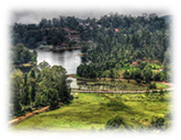
Ooty Lake |
|
|
|
The beautiful Ooty Lake is a favourite haunt of tourists. It was constructed in
the year 1825, through the initiatives of Mr. John Sullivan, the then Collector
of Coimbatore. This lake was built in order to provide an irrigation tank to the
people.
|
|
|
|
|
|
|
|
Kandal Cross Shrine |
|
|
|
Kandal cross, a Roman Catholic Shrine considered, as the Jerusalem of the East
is located in Udhagamandalam in Tamil Nadu.
|
|
|
|
|
|
|
|
Excursions |
|
|
|
Mudumalai Wildlife Sanctuary and National Park |
|
|
|
The Mudumalai wildlife sanctuary is located where the Nilgiri Hills, the
offshoot of the Western Ghats meet the Eastern Ghats. The Mysore - Ooty highway
runs through the sanctuary, following the course of the Mayyar River, which
separates Mudumalai from Bandipur.
|
|
|
|
|
|
|
|
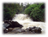
Kalhatty Falls |
|
|
|
The Kalhatty falls are located on the Kalhatty slopes at about 13-km from
Udhagamandalam on the Udhagamandalam - Mysore Kalhatty ghat road. Also known as
the "Kalahasti Falls", the water here cascades down a height of 122m.
|
|
|
|
|
|
|
|
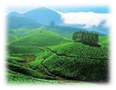
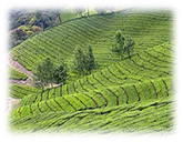
The Tea
|
|
|
|
The establishment of numerous tea estates made Ooty famous. Lofty mountains,
dense forest, sprawling grasslands and miles and miles of tea gardens greet the
passengers on most routes. The annual Tea and Tourism Festival attracts crowds
in huge numbers.
|
|
|
|
|
|
|
|
Fairs & Festivals
|
|
|
|
A summer festival is held each year during the month of May in the Botanical
Gardens, which is an added attraction for tourists. The Flower Show is the pride
of the festival.
|
|
|
|
|
|
|
|
How To Get There
|
|
|
|
By Air : Coimbatore, 105 km from Ooty, is the nearest airport.
|
|
|
|
By Rail : Ooty is on the narrow gauge railway, connected to Mettupalayam
(47 km), which is directly connected to Coimbatore and Chennai. The famous toy
train connects Ooty with Mettupalayam and Coonoor.
|
|
|
|
By Road : A good network of roads and national highways connect Ooty with
all major towns and cities.
|
|
|
|
|
|
|
|
|
Kodaikanal
|
|
Location : TTamil Nadu |
 |
Kodaikanal located amidst the folds of the verdant Pali hills is one of the most
popular serene hill stations in India, which mesmerises any visitor. With her
wooded slopes, mighty rocks, enhancing waterfalls and a beautiful lake,
Kodaikanal is a charming hill station.
Kodai is situated at an altitude of about 2,133-m high and covers an area
of 21.45-sq-km. The hill town is renowned for its educational institutions of
international repute. The pride of Kodaikanal is the 'Kurinji-flower', which
blossoms once in 12 years. The hill-plantain fruits and plums are known for
their freshness and taste.
|
|
|
|
Prime Attractions
|
|
Berijam Lake |
|
|
|
|
|
Berijam Lake located at a distance of 21-km from Kodaikanal in Tamil Nadu is one
among the beautiful lakes of South India. Spread over an area of 24 hectares,
the lake is star shaped and is known for its pure water.
|
|
|
|
|
|
|
|
Bryant Park: Bryant Park situated on the
eastern side of the lake, is noted for flowers, hybrids and rafts.
|
|
|
|
|
|
|
|
The Glass House: The Glass House is an added
attraction. It hosts the annual horticultural show held here in May.
|
|
|
|
|
|
|
|
Shenbaganur Museum: Shenbaganur Museum,
located about 5-Km from the lake is one of the best orchidoriums in the country
with more than 300 species of orchids and wide-ranging collection of birds are
found here.
|
|
|
|
|
|
|
|
Kodaikanal Lake: It is a magnificent man-made lake, which spreads out in
a star shape over sixty acres set among the greenery. Boating and Angling
facilities are available at the Kodaikanal Lake If you wish to have a panoramic
view of the Kodai valley, then you should climb up the Pillar Rocks measuring to
a height of about 122 meters provides a panoramic view.
|
|
|
|
|
|
|
|
Coaker's Walk: Coaker's Walk derives the name from Lt. Coaker, who
prepared the map of Kodai and it is about a kilometer from the lake, which runs
along a steep slope on the southern side of the Kodai.
|
|
|
|
|
|
|
|
Silver Cascade waterfall: It is located on the Ghat Road about 8-km from
Kodaikanal. The overflow of Kodai Lake comes down here as 180 feet high falls.
|
|
|
|
|
|
|
|
How To Get There
|
|
|
|
By Air : The nearest airport is at Madurai (120 km from Kodaikanal).
|
|
|
|
By Railway : The nearest railway stations are the Kodai Road Railway
Station (80-km) and the Palani Railway Station (64-km).
|
|
|
|
By Road : Kodaikanal is connected by road with Chennai (520-km), Ooty
(264-km), Trichy (197-km), Coimbatore (175-km), and Madurai(120-km).
|
|
|
|
|
|
|
|
Climate
|
|
|
|
The climate of Kodaikanal is pleasant throughout the year, but the best time to
visit Kodaikanal is from April to June and from September to October.
|
|
|
|
|
|
|
|
|
Munnar |
|
Location : KKerala
|
 |
Munnar is a breathtakingly beautiful and an idyllic tourist destination in
Kerala. Set at an altitude of 6000 ft in Idukki district, Munnar was the
favourite summer resort of the erstwhile British rulers in the colonial days.
It's famous for tea plantations- pristine valleys and mountains. One can see the
exotic species of flora and fauna in its wild sanctuaries and forests. Munnar is
located 130 km from Kochi.
Munnar is the confluence of the three mountain river systems mudrapuzha,
Nallathani, Kundala. It is dotted with lakes, reservoirs, mountains streams,
scabrous rocks, wooded valleys and wavy green hills, which make it a fascinating
holiday destination. The unending dominance of the tea plantations and the
mountain flower Neelakkurinji that bloom once in 12 years are both synonymous
landmarks of Munnar. It is one of the top tea production centres in all of
India.
|
|
Prime Attractions |
|
Pothamedu: |
|
It is a scenic spot offering majestic views of the tea, coffee and cardamom
plantations in Munnar. The undulating hills, the lush mountain and the
incredible scenery here is ideal for trekking and extensive mountain walks.
|
|
|
|
|
|
|
Devikulam:
|
|
|
|
It is an idyllic hill station and the most sought-after among the tourist
attractions of Munnar featuring sprawling lawns, exotic flora and fauna and the
cold mountain air. You will also find Sita Devi Lake with its mineral rich water
and charming ambiance and is an ideal picnic spot. This place is ideal for trout
fishing.
|
|
|
|
|
|
|
|
Mattupetty: |
|
|
|
It is located at a height of 1700 meters and famous for its highly specialized
dairy farm. You can visit the cattle shed farms at this place on your tour to
Munnar. Besides, the Mattupetty Lake and dam is a short distance from the farm
and is a beautiful picnic spot. You can also get boating facilities on the
Mattupetty Dam that would simply be exciting.
|
|
|
|
|
|
|
|
Excursion
|
|
|
|
Nyayamakad:- It is located at a distance of 10 kms from Munnar and is a
land of incredible waterfalls. The sight of waters cascading down a hill from a
height of around 1600 meters is an awe-inspiring one. The captivating
surroundings make an outstanding picnic spot and trekking point.
|
|
|
|
|
|
|
|
Eravikulam National Park: This flourishing national park is home to the
Nilgiri Tahr and also to the Anamudi Peak which is located in the Southern
region of the park. It was initially established to protect the Nilgiri tahr
(Nilgiri Ibex) and was recognized as a national park in the year 1978. It is
spread over an area of 97 sq kms and is one of the most sought-after among the
tourist attractions of Munnar. This park is remarkably beautiful and is a gem to
the crown of Munnar.
|
|
|
|
|
|
|
|
How To Get There
|
|
|
|
By Air : The nearest airport is Kochin, 130 km away from Munnar which is
connected to all the cities in India. |
|
|
|
By Railway : Kochin is the nearest railway station, which is connected to
all the major cities in India.
|
|
|
|
By Road : Munnar is accessible by road from most of the cities and town
in Kerala. You can also reach Munnar form Coimbatore (6 hrs away) and Madurai (6
hrs away) in Tamil Nadu.
|
|
|
|
|
|
|
|
Climate |
|
|
|
Munnar experiences a moderate climate all through the year. Summers (March to
May) are pleasant and the temperature ranges a maximum of 25°C to minimum of
15°C. Winters during December to February are cool and temperature comes down to
10°C during this period. Monsoons (June to September) are lovely with pouring
rainfalls. Best time to visit here is all through the year especially from
August to May. A visit to the tea garden during summers is enjoyable.
|
|
|
|
|
|
|
|
|
Coorg>
|
|
Location : Western Ghats, Karnataka.
|
 |
Easily one of the most attractive regions in India, Coorg or Kodagu is an
enchanting expanse of natural tourist spot that nestles amid the hills and
valleys of the picturesque Western Ghats.
The Kodagu people have always stood apart handsome, brave and hospitable. A
distinguished martial tradition has given the Indian Army several Generals and
Brigadiers. Kodagu district has several tourist spots of historic, epic and
natural importance. Kodagu has three taluks- Madikeri, Virajpet and Somwarpet.
Steep hills, valleys and gorges with countless streams that gurgle through them,
beckon intrepid trekkers and rock climbers.
|
|
|
|
Prime Attractions
|
|
Madikeri Fort |
|
Madikeri Fort, located at Madeikeri, was built in the 19th century. The monument
houses a chapel, a temple, a prison and a museum inside. One can have a
breathtaking view of the whole Madikeri town from this fort.
|
|
|
|
|
|
|
|
|
Raja's Seat |
|
|
|
According to legends and folklore, the Kodagu Kings spent their evenings in this
place, which is a spectacular garden in the town of Madekari. One can have an
impressive view of the sunset from this place.
|
|
|
|
|
|
|
|
Iruppu Falls |
|
|
|
The Iruppu Falls harbor a Hindu temple and serve as a place of pilgrimage for
the various tourists visiting Coorg. The temple is believed to be dedicated by
Lord Rama to Lord Shiva. Owing to its enchanting beauty, this waterfall is also
a famous picnic spot.
|
|
|
|
|
|
|
|
Abbey Falls |
|
|
|
Located amidst a valley in a coffee-cardamom plantation, 7 km from Madikeri, are
the Abbery Falls. With water falling from a height of 70 ft, this is a famous
waterfall and a much-visited picnic spot of Coorg.
|
|
|
|
|
|
|
|
Omkareshwara Temple |
|
|
|
Built in 1820 AD by Lingaraja, this is a well-known temple in Coorg. With its
immaculate architecture, that blends Gothic and Islamic style, this temple is
believed to be dedicated to Lord Shiva.
|
|
|
|
|
|
|
|
Excursions
|
|
|
|
Nagarahole National Park |
|
|
|
This wildlife sanctuary, which shelters elephants, tigers, spotted deer,
leopards, bison, peacocks and other exotic wildlife, is a favorite among the
tourists. There are lodging facilities inside the park, which makes it a
much-visited tourist spot.
|
|
|
|
|
|
|
|
How To Get There
|
|
|
|
By Air : The nearest airport from Coorg is Mangalore (135kms).
|
|
|
|
By Railway : Mysore is the most convenient railhead from Coorg. The city
is only less than 2½ hours drive from Coorg and is also connected to the rest of
India with extensive rail network.
|
|
|
|
By Road : There is a well-laid-out network of roads connecting the city
with important cities in Karnataka. Cities like Mysore (120 kms), Hassan
(115kms), Mangalore (136kms) and Bangalore (256kms) are linked by roadways with
Coorg.
|
|
|
|
|
|
|
|
|
Wayanad |
|
Location : Kerala
|
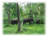 |
Wayanad, One of the fourteen districts in Kerala (India) is situated in an
elevated picturesque mountainous plateau in Western Ghats. Providing a panorama
of undulating mist clad hills and dales, Wayanad is blessed with a unique
geographical position. Luxuriant plantations of coffee, tea, cardamom, pepper
and rubber are strewn all over the hills of Wayanad. Situated at a height of
700-2100 m above sea level, it is bound on the east by the Nilgiris and the
Mysore districts of Tamilnadu and Karnataka respectively. The natural scenic
beauty of Wayanad and its rich natural resources offer several opportunities for
adventure tourism.
|
|
|
|
Prime Attractions
|
|
Banasura Dam |
|
Banasura Dam, located in the north west of Kalpetta, is regarded as one of the
largest earth dams in India. It is an ideal picnic place surrounded by lush
green hills and a vast body of crystal clear water.
|
|
|
|
|
|
|
|
|
Wayanad Wildlife Sanctuary/td>
|
|
|
|
Established in 1973, the Wayanad Wildlife Sanctuary is contiguous to the
protected area network of Nagarhole and Bandipore of Karnataka and Mudumalai of
Tamilnadu.
|
|
|
|
|
|
|
|
Edakkal Caves |
|
|
|
Edakkal Caves are two natural caves located about 25 km away from Kalpetta and
just 3 km away from Ambalavayal. These caves are famous for the ancient carvings
and pictorial writings dating back to the new Stone Age. They can be accessed
only by a 1 km trekking trail from Edakkal.
|
|
|
|
|
|
|
|
Chembra Peak |
|
|
|
Located amidst panoramic surroundings, the peak is at an altitude of 2,100m
above sea level. An ideal spot for trekking, Chembra Peak is a very beautiful
spot close to the Western Ghats. The Chembra Hills and the adjacent Meppadi
hills are accessible from Kalpetta.
|
|
|
|
|
|
|
|
Lakkidi |
|
|
|
Lakkidi, the gateway of Wayanad, is situated 700 m above mean sea level, at the
crest of the Thamaraserri ghat pass. Lofty peaks, gurgling streams and luxuriant
forests add magic to the journey up the winding roads to this hill station.
|
|
|
|
|
|
|
|
Kalpetta |
|
|
|
This is where the headquarters of the Wayanad District are located. A stronghold
of the Jains in the past, the famous Ananthanathaswamy Jain Temple is situated
at Puliyarmala near Kalpetta.
|
|
|
|
|
|
|
|
Excursion
|
|
|
|
Vythiri |
|
|
|
Vythiri is a picturesque place located in the sylvan Northern High Ranges of
Kerala in Wayanad District. Exclusive, comfortable, refreshing, pollution free
and inspiring.
|
|
|
|
|
|
|
|
How to Get There
|
|
|
|
By Air : The nearest airport is Karipur Airport (Calicut International
Airport) at Kozhikode, which is about 100 km away from Wayanad city.
|
|
|
|
By Railway : The nearest railway station is at Kozhikode about 100 km
away from Wayanad.
|
|
|
|
By Road : The Kozhikode - Mysore National Highway 212 (NH 212) passes
through Wayanad district. The excellent road network links Wayanad with places
like Kannur (98 km), Ooty (115 km) and Mysore (142 km).
|
|
|
|
|
|
|
|
Climate
|
|
|
|
Tropical monsoon, seasonally excessive rainfall and hot summer
|
|
|
|
|
|